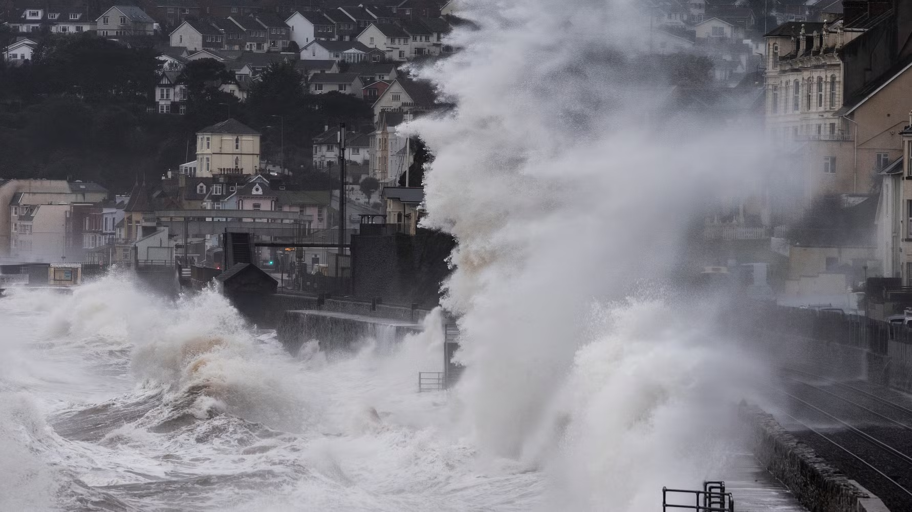
The Royal Society for the Prevention of Accidents (RoSPA) is urging the public to take extra precautions ahead of Storm Bram, which is set to lash the UK with torrential rain and fierce winds.
Storm Bram is set to hit the UK on Tuesday and Wednesday, bringing severe winds and heavy rain. An amber warning for north-west Scotland predicts gusts up to 90mph, while saturated ground in Wales and south-west England increases the risk of flooding. These conditions could cause building damage and major transport disruption.
Yellow warnings will also cover large parts of the UK, including Wales, south-west England, Northern Ireland, and Scotland, with gusts of 50-60mph and locally over 70mph. Combined with heavy rain, this poses significant safety risks, including hazardous travel, delays, and cancellations.
RoSPA advises the public to take immediate steps to reduce the risk of injury and disruption:
Avoid unnecessary travel, especially in areas under Amber warnings or where flooding is likely.
Keep mobile phones and essential devices fully charged in case of power cuts.
Monitor official weather updates and follow instructions from local authorities.
Secure outdoor items such as bins, signage, and garden furniture to prevent damage.
Prepare a basic emergency kit with torches, batteries, and non-perishable food.
Stay indoors during periods of severe weather and ensure windows and doors are shut.
Check in on vulnerable neighbours, particularly those living alone or in rural areas.
Driving safety tips during heavy rain and flooding
Rain reduces visibility and doubles stopping distances: slow down and plan manoeuvres early.
Use windscreen wipers, washers, and dipped headlights at all times.
Aquaplaning happens when tyres lose grip on surface water: reduce speed, maintain correct tyre pressure and tread depth. If it occurs, ease off the accelerator and brakes until grip returns.
On flooded roads: avoid deep water near kerbs, don’t cross if depth is uncertain, and if you proceed, drive slowly in first gear, keep engine speed high, and test brakes after exiting water.
Avoid flooded areas wherever possible.
Steve Cole, Policy Director at RoSPA, said: “Storm Bram isn’t just a risk outdoors; homes may be vulnerable too. Secure garden furniture, bins, and anything that could blow away or cause damage. Indoors, make sure windows and doors are firmly shut and keep an emergency kit ready.”
“On the roads, your regular journey may be difficult. Rain doubles stopping distances and aquaplaning can happen in seconds. Slow down, keep your distance, and never attempt to drive through floodwater. These simple steps can help protect your home, your journey and keep communities safe.”
Motorists are being warned about the dangers of aquaplaning, as experts share tips on how to stay safe on the roads during stormy weather.
Rainfall in the UK is on the rise, with winter 2023-24 the wettest on record,* making it vital that drivers know how to react in these challenging situations.
Car insurance experts at Quotezone.co.uk urge drivers to check their tyre tread depth and significantly reduce their speed when it’s raining to help keep control during unexpected aquaplaning.
Also known as hydroplaning, aquaplaning happens when a layer of water builds up between a vehicle’s tyres and the road surface, causing the tyres to lose grip.
This can lead to a complete loss of steering and braking control, leaving drivers unable to manoeuvre safely until the tyres regain contact with the road.
Even a small amount of water can cause aquaplaning if tyres are worn or under-inflated. The legal minimum tread depth in the UK is 1.6mm, so it’s important for motorists to regularly check their tyres to ensure they meet or exceed this limit.
Drivers are advised to slow down when conditions are wet, as aquaplaning is far more likely to occur at speeds above 35 mph.**
It’s also important to avoid harsh acceleration, braking or sudden steering movements in rainy weather.
When the car is aquaplaning, drivers might notice the engine suddenly becoming louder, feel as though they’ve dropped the clutch down a gear, causing the revs to increase, experience lighter or unresponsive steering, or feel the back end of the car drifting from side to side, also known as ‘fishtailing’.***
In that situation, it’s crucial not to slam the brakes or turn the wheel sharply. Instead, drivers need to gently ease off the accelerator and keep the steering straight until the tyres regain contact with the road.
Greg Wilson, CEO and car insurance expert at Quotezone.co.uk said: “As the weather across the UK gets wetter and stormier, motorists need to be on alert for dangerous driving conditions.
“Many drivers underestimate how easily aquaplaning can happen. Even a thin layer of water can be enough if tyres are worn or speeds are too high.
“It can be a frightening experience when you suddenly lose control of the car, and can result in serious accidents, so knowing how to prevent and manage aquaplaning is crucial at this time of year.
“Regularly checking tyres, slowing down, keeping an eye out for puddles and avoiding harsh manouvers in wet conditions, can all help improve safety while driving in the rain.
“Being aware of the first signs of aquaplaning is also important so that drivers can react calmly and safely. If the steering suddenly feels light or the car starts to drift, don’t panic.
“Staying composed, easing off the accelerator, keeping the wheel straight and letting the tyres regain their grip naturally is the best that you can do in this situation. Being prepared and aware of what’s happening is half the battle.”
Your tyres will have less chance of gripping the road if you’re travelling at a higher speed. There’s no magic “safe speed,” but experts say that cars travelling under 35 mph in an inch or two of water are much more likely to stay in control.
2. Check your tyre tread depth
The legal minimum tread depth is 1.6mm, but don’t wait until you’re right on the limit. More tread means better grip, especially on wet roads. If your tyres are starting to look a little smooth, it’s time to get them checked or replaced,**** driving with unroadworthy tyres can lead to fines, penalty points and could even invalidate your car insurance.
3. Keep tyres properly inflated
Under-inflated tyres can’t clear water as effectively, increasing the risk of aquaplaning. Check tyre pressures regularly, especially before long journeys. If you’re not sure what your tyre pressure should be, check your car manual or reference sticker on the inside of the doorframe.
4. Keep an eye out for puddles
Those big puddles might look harmless, but hitting one too fast can make your car lose contact with the road in an instant. Try to avoid waterlogged roads or drive around puddles safely – if you have to go through, reduce speed and proceed with caution. Turning your headlights on is recommended on rainy days to increase visibility, so other drivers can see you better and you have a better chance of spotting excess surface water.
5. Follow the track
If there’s a car ahead, their tyres will already have cleared some of the water from the road, leaving tracks behind. Driving in those tracks, while keeping a safe distance, could help your tyres maintain better grip.
6. Drive smoothly
Gentle steering, braking and accelerating are key when it’s wet. Take extra care on bends and avoid using cruise control, as it can stop you from reacting quickly if you start to aquaplane.
As a leading price comparison site, Quotezone helps millions of drivers every year compare and find savings on all sorts of car insurance, such as young, older and convicted driver insurance.
With warnings in place for heavy rain, motorists are being advised on how to navigate flooded roads safely.
Motoring experts at LeaseLoco.com have shared their top tips for drivers who find themselves with no choice but to tackle waterlogged routes.
Flooded roads not only pose a serious risk of vehicle damage but can also lead to lengthy standstills and an increased likelihood of accidents.
So motorists have been advised to drive steadily, remain considerate of other road users, and use consistent engine revs to reduce the risk of water damage.
Using a low gear is particularly important, as it helps prevent costly repairs and avoids unnecessary breakdowns that can cause further disruption.
Drivers are also being urged to stay calm and focus on safety by using headlights and maintaining clear visibility.
Patience is key when navigating flooded roads – motorists should take turns, drive through the highest points of the road, and avoid rushing, as panic can lead to accidents.
John Wilmot, CEO and founder of car leasing deals site LeaseLoco said: “Driving through flooded roads should be avoided whenever possible, both for personal safety and to prevent costly damage to your vehicle.
“However, drivers will inevitably encounter waterlogged roads from time to time, so knowing the safest ways to navigate them is essential.
“Water damage to vehicles can be expensive, but maintaining consistent revs while driving through floodwater can help prevent water from entering the engine.
“It’s also important to stay inside your vehicle in flooded areas, as floodwater often contains contaminants from drainage systems that pose serious health risks.
“In wet conditions, vehicles are at risk of losing traction and control – something known as aquaplaning. If this happens, ease off the accelerator gently, keep the steering wheel straight, and avoid braking harshly, as this can worsen the situation.
“By staying calm, driving slowly, and taking proactive precautions, you can protect yourself, your passengers, and your vehicle.”
LeaseLoco’s tips and advice for driving through flooded roads:
Avoid where possible
Driving in floods should be avoided whenever possible, as water deeper than 4 inches can pose significant risks to both passengers and pedestrians. Floodwater may be deeper and faster moving than it appears, so plan your journey carefully and reroute if needed.
Drive slow
It’s crucial to drive cautiously and at reduced speeds in flooded areas, as driving too fast can force water into your vehicle and cause serious damage. Additionally, splashing pedestrians by driving through puddles at speed is against the law.
Drive through the centre
Roads are engineered to dip at the sides, allowing water to run off into drainage systems, so driving through the centre of a flooded road will ensure you’re not driving through more water than necessary.
Oneat a time
Take time and be patient when roads are flooded. Drive cautiously to allow cars to drive through the middle of the road one at a time. For people with larger, more robust cars, be mindful and cautious of other vehicles that might not be as sturdy.
Low gear
Driving in a lower gear and maintaining steady revs can help prevent water from entering the exhaust. If water does enter the exhaust, it can cause hydrolock, potentially resulting in severe engine damage.
Use headlights
Visibility is important when roads are flooded, especially in the evenings, as other drivers might not notice reduced speeds or delays caused by cautiously navigating through the centre of floodwater.
Air conditioning
Prevent your car from misting in floods so that your vision is clear for any potential hazards. Keep air flowing by turning the air conditioning on.
Remain inside the car
Flood water is usually caused from systems overflowing, so the water could be grossly contaminated. Stay inside your car, even if you’re waiting for help. Water may also appear to be more shallow than it really is, which can increase danger to individuals who aren’t confident in water.
Motorists can sign up for flood warnings on the GOV.uk website.
Reluctantly, we have postponed the busy Introduction to Composting workshop and fully-booked W.O.R.M.S Appreciation Day that were set for Saturday 14 June, because of the weather warnings for thunderstorms and heavy rain.
The worm participants didn’t see this issue with this, but the humans thought it could be a pretty miserable wash out and better to postpone!
We hope to re-schedule very soon – updates will go in all the usual places (and if you booked tickets, you should already have an email via Eventbrite)
Do still look out for other @poweroffoodfestival events, which are on from 14-21 June
Travel and safety advice has been issued following a Met Office Amber weather warning for high winds associated with Storm Darragh today (Saturday, 7th December 2024) between 1am and 9pm.
All road users should consider if they really need to travel during the adverse weather or if travel can be delayed until conditions improve.
The Scottish areas affected by the Amber warning are:
Dumfries and Galloway
South Ayrshire
Please visit the Met Office website for more detailed information about the weather warning. Yellow warnings for wind and rain are also in place for parts of Scotland.
Please also be aware of weather warnings in place for other parts of the UK, including a Red weather warning for high winds across parts of Wales and avoid unnecessary travel to areas affected.
Motorists are advised there is a high risk of disruption in the areas affected by the warning and there may be significant delays. Conditions may be hazardous due to the high winds and extra caution should be exercised.
Travellers with bookings on ferries should check with operators for updates on crossings.
https://twitter.com/i/status/1865037333533180020
Chief Superintendent Hilary Sloan, head of Road Policing, said: “Drivers of vehicles vulnerable to being blown over should plan their route to avoid exposed areas, or consider delaying your journey until conditions improve.
“Plan ahead and keep updated by checking the Met Office and Traffic Scotland websites and social media.”
Follow @policescotland and @trafficscotland on X for up-to-date travel information.
Wind
HGV and bus drivers should drive with extreme caution and be aware you may be asked to park at a suitable position by the police.
Drivers of vehicles vulnerable to being blown over should plan their route to avoid exposed areas or consider cancelling your journey until conditions improve.
Cyclists, motorcyclists and pedestrians should consider the risk of being blown over or into the path of other road users.
SEPA: Flooding expected as Storm Darragh arrives
Regional Flood Alerts are in place as Storm Darragh is expected to bring heavy rain and strong winds to much of Scotland on Friday and Saturday.
Localised flooding from surface water and high river levels is possible across parts of southern, central and north-eastern Scotland. This could lead to impacts such as disruption to travel and flooding of low-lying land, roads and isolated properties.
The Met Office also has warnings in place for potentially damaging winds associated with Storm Darragh. High winds may cause dangerous conditions in coastal areas due to wave overtopping and sea spray.
David Morgan, Flood Duty Manager for the Scottish Environment Protection Agency (SEPA), said: “The arrival of Storm Darragh is expected to cause disruption across Scotland today and tomorrow. There’s a risk of surface water and river flooding in central, southern and north-eastern areas due to persistent, and at times heavy, rainfall.
“People living, working and travelling in affected areas are advised to consider any steps they need to take now to be prepared and stay safe. Take care when travelling and plan your journey in advance as impacts may include roads being flooded and disruption to the rail network.
“We have issued Flood Alerts and continue to work with the Met Office to monitor the situation 24/7. Regional Alerts and local Flood Warnings will be reviewed throughout the weekend and updated as necessary.
“We advise people to sign up to Floodline to receive free updates for where they live, or travel through, directly to their phone. People can also check our flood updates for all the latest information and view the three-day Scottish Flood Forecast to see what conditions are expected further ahead.”
Regional Flood Alerts and local Flood Warnings are in place as #StormDarragh brings heavy rainfall to much of Scotland today and tomorrow.
Check the Scottish Flood Forecast: Combining the Met Office’s cutting-edge weather forecasts with SEPA’s data and expertise, the Scottish Flood Forecast provides a clear, three-day outlook that shows when and where flooding is expected, whether from rivers, surface water, or the sea in Scotland. It can also reassure you if flooding is not expected.
Sign Up to Floodline for text, phone call, or email messages for the area where you live or work, allowing you to take action and prepare when flooding is expected.
Follow SEPA on social media: SEPA provide information on predicted flooding in advance through the dedicated @SEPAFlood account on X and its Facebook page.
Visit SEPA’s flooding pages today to access these tools and find out more about how to prepare for and be aware of potential flooding.
Stay safe
Don’t walk through flood water – 15cm of fast flowing water could be enough to knock you off your feet and hazards can be hidden under the water.
Drive with care, and do not travel through deep fast flowing water. It only takes 30cm of fast flowing water to move an average family sized car.
Consider deploying flooding protection products if required.
What’s the difference between a flood alert and a flood warning?
Regional Flood Alerts are early advice that flooding is possible across a wider geographical area. The purpose of the Alerts is to make people aware of the risk of flooding and be prepared. We normally issue them 12 to 24 hours in advance of the possibility of flooding.
Flood Warnings are more locally specific and are issued for areas where we have gauges to measure the exact water height. They are issued at shorter notice when we are more certain that a specific area will be affected.
Motorists are being urged to take extra safety precautions before heading out on the road in heavy rainfall, strong winds, and snowfall.
Motoring experts at Quotezone.co.uk are urging drivers to ensure their cars are roadworthy in all weather conditions and have researched tips for protecting vehicles during storm season.
With storm warnings announced across the country, Brits are being urged to avoid getting behind the wheel, but for those who need to head out on necessary journeys, it’s crucial to take extra precautions to stay safe on the roads.
A survey revealed a third of drivers admit to not slowing down in wet weather and nearly one in three have driven over the speed limit despite these dangerous conditions.
According to The Highway Code, in wet weather the stopping distances are at least double those required on dry roads because water reduces the grip the tyres have on the road.
This means the distance between cars, which the Highway Code recommends as two seconds in dry conditions, should also be doubled, or even tripled in wet conditions.
This should allow drivers sufficient time to react and come to a full stop if needed without hitting the car in front of them.
If a road is flooded, drivers should turn around and find an alternative route as driving through flood water can lead to loss of control and serious damage to vehicles – which car insurance is unlikely to cover.
Motorists should also be mindful of strong winds and keep a strong grip on the steering wheel at all times to prevent being swayed off course, especially when driving past gaps in trees or buildings where they’re more likely to be exposed to side winds.
It’s also important to ensure vehicles are roadworthy and are able to handle heavy rain and strong winds.
Essential checks include ensuring the tyres have adequate tread depth and are properly inflated, windscreen wipers are fully clearing the screen, brake pads and batteries are fully operational and the correct lights are on and working properly.
It’s illegal not to turn your lights on in bad weather when visibility is poor and drivers could face a 12-month ban and £1000 fine. It’s also important to know which light should be used when the weather starts to deteriorate.
Know Your Lights in bad weather:
Headlights – when visibility is reduced
Daytime running lights – activate rear set of lights in poor visibility
Dipped headlights – in dull daytime weather or heavy rain
Fog lights – in foggy conditions so drivers can spot you at a distance
Automatic lights – if these come as standard in your vehicle, double check they are activated in bad weather, as they may not come on automatically in certain conditions such as fog
Greg Wilson, car insurance expert and CEO ofQuotezone.co.uk said: “With heavy rainfall and strong winds expected across the country, we’re urging drivers to take a proactive approach to safety.
“Before getting behind the wheel it’s crucial to carry out a few checks to ensure your vehicle is in top condition. Checking tyre pressure, tread depth, lights, and wipers can make a significant difference in how your car handles adverse weather.
“Many motorists underestimate the impact of weather on driving conditions and failing to adapt your driving style to the conditions can have serious consequences.
“It’s important to reduce speed, maintain a safe distance from other vehicles and be vigilant for potential hazards like flooding and debris.
“Drivers should also check what type of insurance they have – while most comprehensive car insurance policies cover storm damage, motorists who have taken out third-party only or third-party, fire and theft insurance won’t normally be covered.
“Also, drivers who actively drive through flood water are likely to invalidate their insurance and lose protection for any damage – given it was an avoidable situation, and the driver has a duty to safeguard the vehicle.”
Before setting off in stormy conditions, it’s essential to ensure your vehicle is fully prepared for the journey. The essential checks include ensuring the tyre tread depth meets the legal requirements and that the tyres are properly inflated to provide maximum traction on wet roads. It’s also important to make sure that all lights and wipers are functioning correctly, as visibility can be drastically reduced in heavy rain.
Reduce speed
Drivers need to reduce speed to improve vehicle control and allow themselves time to react in unexpected situations such as sudden stops or fallen trees on the road. This is because the stopping distances double on wet roads due to the reduced grip that tyres have on the water.
Increase distances
It’s important to leave a larger gap between your vehicle and the one in front to give yourself ample time to react in case the car ahead stops suddenly. Aim for at least a four-second gap in wet conditions, and consider increasing it further during heavy rain or when visibility is limited.
Don’t drive through a flood
Flooded roads pose significant risks, including the possibility of losing control, stalling or damaging the engine. Even shallow water can conceal hazards like deep potholes or debris. Also, most car insurance policies won’t cover you for damage if you drive through flooded water.
Keep a strong grip on the steering wheel
Strong winds can make it difficult to maintain control of your vehicle, especially when driving through open areas where you’re more exposed to side winds. A firm grip on the steering wheel helps you react quickly to unexpected gusts of wind.
Beware of aquaplaning
Aquaplaning occurs when water builds up between the tyres and the road, causing the vehicle to lose traction and making it difficult to steer and brake. If you feel the steering becomes lighter or the car begins to slide, ease off the accelerator, don’t brake and allow your car to slow down naturally.
Use the right light
In heavy rain or poor visibility, it’s important to double check your lights are on, dipped headlights allow other drivers to see you more easily. They’ll be seen from a much greater distance than sidelights and they won’t dazzle other drivers or pedestrians.
Quotezone helps millions of drivers right across the UK find essential savings and better insurance across a whole range of products such as car, van and motorbike insurance.
Red Weather Warning for Wales and South West England: The Met Office has issued a rare red warning for Wales due to Storm Darragh, with winds expected to reach up to 90 mph, posing significant risks to safety and infrastructure.
Amber Warnings for Scotland and Northern Ireland: Scotland and Northern Ireland are also under amber warnings, anticipating severe weather conditions that could lead to widespread disruption.
Safety Precautions Urged: Authorities are advising residents to secure loose objects, avoid travel, and prepare for power outages to stay safe during the storm.
The Met Office has warned that gusts of up to 90 mph (144 km/h) or more are possible, particularly over the coasts and hills of west and south Wales. The caution is currently in place from 03:00 to 11:00 on Saturday, December 7th.
Additionally, amber warnings have been issued for Scotland and Northern Ireland, as well parts of the South West of England, with many events being cancelled across the UK.
The rare red weather warning has been issued for Wales ahead of Storm Darragh, which is expected to bring extremely strong and damaging winds this weekend.
Here are some important safety tips to help you stay safe:
Secure loose objects: Ensure that any loose items outside your home, such as garden furniture, are secured or brought indoors to prevent them from being blown away.
Avoid travel: If possible, avoid traveling during the peak of the storm. If you must travel, check the weather forecast and road conditions before setting off. Many events have now been cancelled
Stay indoors: Stay inside during the storm, especially during the peak hours from 03:00 to 11:00 GMT on Saturday, December 7th.
Prepare for power cuts: Have an emergency kit ready with essentials such as torches, batteries, and non-perishable food in case of power outages.
Stay away from windows: Keep away from windows and glass doors to avoid injury from flying debris.
Charge your devices: Ensure your mobile phone and other essential devices are fully charged.
Check on vulnerable neighbours: If it is safe to do so, ensure that they are secure and have everything they need. .
RAC Breakdown spokesperson Alice Simpson said: “A red weather warning is highly unusual and should be heeded as it can indicate a risk to life.
“With parts of Wales and the South West set to be battered by the wind between 3am and 11am on Saturday, we strongly advise drivers to postpone their journeys if they can. Anyone who must drive should stick to major roads, reduce their speed significantly, always keep a firm grip of the steering wheel and be on high alert for debris in the road.
“Exposed rural and coastal routes will be particularly treacherous. Drivers in these areas should be wary of any high-sided vehicles as they are at risk of being buffeted off course or, worse still, blown over. We also suggest parking well away from large trees due to the danger of falling branches or whole trees being uprooted.”
For more detailed advice on staying safe during strong winds, you can visit the Met Office’s stay safe in winter driving page and the RoSPA website
Musselburgh Racecourse has ABANDONED today’s (30 March) Virgin Bet Easter Saturday Race Day.
The East Lothian track took the difficult decision to call off the meeting after further rainfall this morning which made the course unsafe for jockeys and horses.
All ticket holders will be contacted with information on how to transfer their booking to another meeting or to receive a full refund.
Racecourse director Bill Farnsworth said: “Unfortunately racing has been abandoned. We had 15mm of rain yesterday and a further 3.25mm of rain this morning between 5am and 6am.
“It has been an incredibly wet winter and the ground is very wet. Normally Musselburgh could handle this kind of weather but the water table must be so high, that this has not happened.
“The ground is saturated in places and our priority must be the safety of the jockeys and the horses. It is very disappointing, we had a brilliant day lined up for our race goers and we are sorry to have to abandon racing.”
The Scottish Environment Protection Agency (SEPA) have warned communities to stay vigilant as the weekend of severe weather continues across Sunday evening and into Monday morning.
Multiple Flood Warnings and Alerts are in place across Scotland, with the focus remaining on the Spey and Tay catchments.
While local Flood Warnings in some areas of Scotland may start coming off over the evening as rivers fall, others will stay in force as some waters continue to rise and the agency continues to warn of likely impacts as communities count the cost of the weekend’s flood damage.
Ruth Ellis, SEPA’s Flood Duty Manager, said: “Today the focus turned to communities across the North, with a particular concern for severe flood impacts to communities along the Spey and Tay rivers.I want to be clear that communities in these areas should stay alert over the evening as some rivers will continue to rise over the course of the evening. The risk to life remains.
“It’s been a difficult weekend across Scotland, with severe weather causing widespread travel disruption to road and rail networks and impacts in communities all over Scotland. Across many areas of the country there is still some deep standing water and it’s really important people understand the danger.
“Hazards can be hidden, so please don’t walk or drive into flood water. Remember that not only is flood water likely to be dirty, 30 cm of fast flowing water can move an average family sized car, and just 15 cm of fast flowing water could be enough to knock you off your feet.
“Our teams have been working around the clock with partner agencies, including Scottish Government, the Met Office, emergency services and local authorities across this major weather event. We will continue to provide information and support in the coming days and weeks to ensure Scotland recovers from this event and becomes more resilient to future flooding.
“We’ll be continuing to issue further updates across the evening to communities across northern Scotland and our advice remains for people to keep up to date with information from sepa.org.uk and follow guidance from emergency services.”
Update 9am, Sun 8th Oct – Flooding focus turns north as SEPA warn communities to stay alert
The Scottish Environment Protection Agency (SEPA) have warned communities to stay vigilant as the weekend of severe weather continues across Sunday.
Multiple Flood Warnings and Alerts are in place across Scotland as the agency continues to warn of likely impacts on Sunday and communities count the cost of Saturday’s flood damage.
Vincent Fitzsimons, SEPA’s Flood Duty Manager, said: “It’s been a rough weekend across Scotland, with severe weather causing widespread travel disruption to road and rail networks and impacts in communities from Greenock to Aviemore.
“Our teams have been working around the clock with Scottish Government and the Met Office in the lead into and across this major weather event. We have been issuing Alerts and Warnings to communities at risk and supporting first responders.
“Today the focus continues to turn to communities across the North, with a particular concern for severe flood impacts to communities along the Spey and Tay rivers. It’s a day to stay alert, not stand down. The risk to life remains.
“We’ll be issuing further updates across the day to communities across northern Scotland and our advice remains for people to keep up to date with information from sepa.org.uk and follow guidance from emergency services.”
People are being urged to avoid travel by road in Argyll and Bute and to consider carefully travel in other areas most impacted by the weekend’s severe rainfall.
SEPA has indicated up to a month’s worth of rain could fall in some areas over the course of the weekend. Rainfall is causing significant disruption in parts of Scotland, including road closures and rail service cancellations.
https://twitter.com/i/status/1710746869255520617
On Saturday afternoon the Met Office issued an Amber Warning for rain extending across Angus, Perth and Kinross, Aberdeenshire, Moray and Highland until 2pm on Sunday.
In Argyll and Bute, the Local Resilience Partnership has established a Care for People Sub-Group, led by the local Health and Social Care Partnership, which is working to identify and reach vulnerable people that may be difficult to reach, with assistance from the voluntary sector. Argyll and Bute Council is assisting by contacting community groups in affected areas with a view to initiating local support, such as opening up community halls.
On Friday the Met Office issued an amber warning for rain, covering Inverclyde, Renfrewshire, East Renfrewshire, Glasgow, North Lanarkshire, East and West Dunbartonshire, Argyll and Lochaber, parts of Stirling, Perthshire, Aberdeenshire and the Highlands. It is in place until 6 am on Sunday. Yellow warnings for rain remain in place for other large parts the country and are updated on the Met Office website.
The greatest impacts earlier on Saturday were experienced in Inverclyde, Renfrewshire, East Renfrewshire, Glasgow, North Lanarkshire, East and West Dunbartonshire, Argyll and Lochaber, parts of Stirling, Perthshire, Aberdeenshire and the Highlands. In Argyll and Bute, several roads have been closed due to flooding and landslides, including:
the A83 between Tarbet and Inverary
the A815 between Dunoon and the A83
the A816 between Lochgiphead and Oban
the A85 at Loch Awe
Road operating companies are assisting Police Scotland with the closures and clear up operations, however due to the continuing rainfall it will not be possible to make an assessment of the landslides or undertake clear up operations until conditions improve.
Network Rail has reported many incidents of severe flooding across the network, resulting in widespread cancellations to services. This includes suspension of services between Inverness and Perth. Services running across the whole ScotRail network have been cancelled, delayed or revised.
On Saturday afternoon Justice Secretary and Minister for Resilience Angela Constance chaired a meeting of the Scottish Government’s Resilience Committee (SGoRR), which was attended by First Minister Humza Yousaf, Transport Secretary Màiri McAllan, Transport Minister Fiona Hyslop and key responder agencies.
They discussed the immediate response to the local impacts, as well as further actions being taken to support those communities most affected.
Ms Constance said: “As the weather warnings outline, heavy rainfall is expected to continue in many parts of the country into Sunday and some areas will have a month’s worth of rain over the course of the weekend.
“I would urge everyone across the country to heed the travel warnings being issued by Police Scotland and others – in particular, drivers in Argyll and Bute should avoid travel due to the significant disruption across the road network.
“We are aware that the initial, most severe impacts have been felt by people and businesses in Argyll and Bute, as well as other areas in the west and north of the country.
“Ministers are receiving regular updates on the situation from partners, including SEPA, the Met Office, and Police Scotland as it unfolds. This afternoon I convened SGoRR in recognition of the severity of the situation which will continue to develop over the next 24 hours.
“I am grateful for the efforts of partners and volunteers to help the public stay safe and where possible to restore services.
“Anyone seeking live updates should follow these partners organisations on social media, and can also consult the Ready Scotland website for general advice.”
Police Scotland Assistant Chief Constable Tim Mairs said: “Officers have been dealing with significant disruption on the roads caused by the heavy rainfall and we would expect this to continue into Sunday.
“It is important that we do everything we can to keep people safe and officers are out in communities helping those who need us.
“Our advice is to plan ahead and consider if your journey is really necessary or if it can be delayed until conditions improve. If you need to travel, please drive to the conditions and take extra time for your journey.”
Vincent Fitzsimons, Flood Duty Manager for the Scottish Environment Protection Agency (SEPA), said yesterday: “SEPA has issued Regional Flood Alerts and more locally specific Flood Warnings across Scotland due to the major rainfall event that is bringing prolonged, heavy rain throughout the day and into Sunday.
“I want to be very clear that this is not a normal Autumn day for Scotland. We’re expecting extensive river and surface water flooding in affected areas. There is a danger to life. There will be widespread impacts to road and rail. There is a risk of more significant community scale property flooding.
“Rain will move across central and western parts this morning, moving northwards through the day. Many areas will see heavy rain for well over 24hrs before it clears on Sunday. Of particular concern are communities in the amber area that extends from west central Scotland northwards.
“Further Local Flood Warnings are likely to be issued, people can always check our Flood Updates for all the latest information. We advise people living, working and travelling in the affected areas to consider any steps they need to take now to be prepared for flooding impacts and consider whether their journey is necessary.”
The Scottish Environment Protection Agency (SEPA) issues flood alerts and warnings for Scotland. View the latest updates on their website.
Vincent Fitzsimons, Flood Duty Manager for the Scottish Environment Protection Agency (SEPA), said: “Scotland is experiencing a major rainfall event that is bringing prolonged, heavy rain throughout the day and well into Sunday.
“I want to be very clear that this is not a normal Autumn weekend for Scotland. We’re expecting extensive river and surface water flooding in affected areas. There is a danger to life. There are widespread impacts to road and rail. There is a risk of more significant community scale property flooding.
“Heavy rain has been falling since Friday night in many areas and will continue in northern Scotland throughout Saturday evening and well into Sunday. Some areas will have seen more than a month’s rain by the end of the weekend.
“Of particular concern are communities in the Met Office amber weather warning area that extends across much of northern Scotland. Examples include Aviemore and communities down the Spey Valley, but many more communities are also at risk. SEPA has been working closely with partners to help them target support for these areas.
”People should check our live Flood Updates for all the latest information. We advise people living, working and travelling in the affected areas to consider any steps they need to take now to be prepared for flooding impacts and consider whether their journey is necessary.
“We will continue to keep a very close eye on the situation, monitoring 24/7 as well as working closely with the Met Office and other partner agencies.
“We would strongly advise people to sign up to Floodline to receive free updates and heed emergency service and local authority advice.
NFU Mutual is issuing flood advice as the Met Office issues an amber warning for heavy rain across many Scottish communities.
Up to 180mm of rain could fall throughout Saturday and into Sunday, with Grampian, Central, Tayside, Fife, Strathclyde and the Highlands all in danger of disruptive and dangerous downpours and flooding.
Heavy rain could lead to flash flooding with fast moving water, cutting off transport routes, and leading rural insurer NFU Mutual is urging home and business owners in Scotland to fortify their properties if possible but make safety their priority.
If they are affected by flooding, people should look at how they can work with their insurer to repair their property to be more resilient to flooding in the future.
Andrew Chalk, home insurance specialist at NFU Mutual, said:“Time and again we’ve seen how destructive and disruptive flash flooding can be for communities, and NFU Mutual Agents in Scotland stand ready to rapidly assist people impacted by these predicted downpours – including facilitating rapid payments for smaller claims and mobilising our network of loss adjusters and repairers.
“But the best way to avoid disruption, if possible, is to take some sensible steps provided by NFU Mutual to protect your property. If you have flood defences, activate them now, move valuable possessions and electrical items to higher ground and prepare a flood or extreme weather pack.
“Have your insurer’s details to hand and if you are impacted by flooding, be sure to ask your insurer and loss adjuster about flood resilient repairs. Since 2017, NFU Mutual has offered its Flood Resilient Repair scheme to all home insurance customers. As part of the scheme, customers who suffer flood damage above £10,000 receive a contribution from NFU Mutual to implement repairs which will protect the property from future flooding.
“According to NFU Mutual claims data, the average damage to a home caused by floods in 2022 was £20,706. A flood resilient home, using things like non-return valves, tiling, and resilient materials on lower floors can massively reduce this bill, and many resilient repairs will cost no more than like-for-like repairs.
“With more insurers also now offering flood resilient repairs under the Government-backed Build Back Better scheme, it is worth checking if you can access extra help if you suffer a flood.”
NFU Mutual flood advice
NFU Mutual’s flood preparedness checklist:
Check if your property is at risk of flooding on the Government website.
Sign up for flood alerts on the Government website – these can be sent by text, email or delivered by phone call.
Put a flood plan in place, including:
Moving valuables – including electric items – to a safe space
Thinking about vulnerable members of your household and neighbours
Noting down useful numbers like gas and electricity suppliers, the National Grid, local council and insurer
Ensuring you know how to switch off your mains electricity and gas supply
Consider procuring sandbags or other flood defence systems
Prepare a flood or storm back, including:
Bottled water and snacks
Food for vulnerable household members like babies, children, and elderly relatives
Pet food
Torches with charged batteries
Mobile phone power banks and chargers
What to do if your home is flooded:
Make safety your priority. Keep your family and pets away from the flood water and move to another part of the property.
Call your insurer immediately, asking about alternative accommodation if your property is unsafe.
Contact family and friends.
If you can, switch off mains gas and electricity supplies in the affected area.
Have a pack with essential items like prescriptions, other medicines and food, paying particular attention to items like baby food.
Have a torch and charged mobile phone on hand in case of power cuts.
When it’s safe to enter the flooded area again, catalogue all damaged items for insurance claims and begin clearing and drying out the area, seeking advice from your insurance company.
Business owners should remain in contact with employees and customers.
NFU Mutual’s flood resilient repairs checklist
Flood resilient repairs are repairs carried out following flood damage which help prevent extensive damage in any subsequent flood. Some may come with additional cost, but many will cost no more than restoration. Resilient repairs to ask your loss adjuster or insurer about include:
Raising electrical sockets and white goods away from floor level.
Replacing flooring with waterproof tiling and grout.
Waterproof paint.
Installing flood-resistant, self-sealing air bricks.
Fitting non-return valves to drains to prevent backflow flooding.
Replacing doors with waterproof doors to prevent floodwater spreading.
Fitting flood barriers to doors or air brick covers.
Permeable paving or driveways.
Inflatable toilet pan seals or bungs to prevent backflow.
uPVC skirting boards and kitchen units.
Removable doors.
Basement tanking or pump systems (integrated or portable).
Spray and flooding probably leading to difficult driving conditions and some road closures
Delays and some cancellations to train and bus services are likely
Homes and businesses are likely to be flooded, causing damage to some buildings
A good chance some communities will be cut off by flooded roads
Fast flowing or deep floodwater is likely, causing danger to life
Marc Becker, Flood Duty Manager for the Scottish Environment Protection Agency (SEPA), said: “Heavy rain from around midnight on Thursday into Friday morning could cause flooding from rivers and surface water in central and southern Scotland.
“Impacts may include flooding in communities, properties and agricultural land. Disruption to the transport network is also likely, including difficult driving conditions. Parts of Dumfries and Galloway and the Borders in particular could experience significant impacts.
“Regional Flood Alerts and local Flood Warnings are in place. People living and working in affected areas are advised to plan their essential journeys and consider the steps they need to take now to be prepared and to stay safe. Anyone out walking is urged to be extra cautious, even around small watercourses. They can also keep updated on floodline.sepa.org.uk.
“SEPA works 24/7 to monitor conditions and is in close contact with the Met Office and other partners to understand and communicate the flooding risk.”
Staying informed
Check the latest information on SEPA’s regional Flood Alerts and local Flood Warnings at sepa.org.uk/floodupdates.
Check the latest advice on what to do to prepare for flooding at floodlinescotland.org.uk
Register for SEPA’s free Floodline alert service by calling 0345 988 1188 or by clicking floodlinescotland.org.uk
The @metoffice has issued a YELLOW weather warning for THUNDERSTORMS today (Tuesday 27th July) from 12:00 – 23:59 and a YELLOW weather warning for RAIN tomorrow (Wednesday 28th July) midnight – Thursday 29th July) 06:00am.
David Faichney, SEPA’s Duty Flooding Manager said: “A mix of heavy rain and thundery showers are expected across much of the country from Tuesday to Thursday, with the worst affected areas likely to be Easter Ross and the Great Glen, Findhorn, Moray, Nairn and Speyside, Tayside, Central, Edinburgh and Lothians and West Central Scotland.
“Due to the nature of thundery showers, it’s hard to pinpoint exactly where will be worst hit, but what we do know is that it can happen quickly and can be highly localised.
“It’s important that those out and about, holidaying, engaging in activities near rivers and streams or out hillwalking are aware of the hazards and stay safe. Some rivers and streams can rise to dangerous levels very quickly, so avoid camping near water and be very mindful of conditions if considering activities such as swimming or canoeing.
“15 regional Flood Alerts have been issued, and people living and working in affected areas are advised to plan their journeys and consider the steps they need to take now to be prepared, including keeping flood protection products, like sandbags, in place in high risk areas. You can stay up to date with regional Flood Alerts and local Flood Warnings at sepa.org.uk/floodupdates.
“Extreme weather such as prolonged heavy rain following a period of warm, dry weather, is something we will see more of as our climate changes and these patterns become more common in the future.
“SEPA is working 24/7 to monitor rainfall and river levels and is in close contact with the Met Office and other partners to review the forecasts, which are combined with local expertise from all regions of Scotland to understand and present the flooding risk. We would encourage the public to remain vigilant, especially in isolated, low lying agricultural areas susceptible to flooding. The most up-to-date information is always available on our website.”
Thunderstorms
Thunderstorms can cause very intense and localised torrential downpours, with potential dangerous flash flooding impacts.
It is very hard to predict where exactly impacts may be experienced; it can also happen suddenly, so it is important you are prepared and remain vigilant.
It is your responsibility to take action to protect yourselves and your property against flooding, for information on how to prepare visit, www.floodlinescotland.org.uk.
Be careful on the roads. Spray and sudden flooding can lead to difficult driving conditions. You should not drive through flood water.
Don’t walk through flood water – 15cm of fast flowing water could be enough to knock you off your feet and hazards can be hidden under the water.
Drive with care, and do not travel through deep fast flowing water. It only takes 30cm of fast flowing water to move an average family sized car.
If you are walking beside rivers be extra careful of wet footpaths and possibly small watercourses in spate.
Please consider deploying flooding protection products if required.
What’s the difference between a Flood Alert and a Flood Warning?
We use forecast weather information provided by the Met Office combined with our own observation of rainfall and river levels and advanced hydrological modelling to provide advance warning of flooding.
Regional Flood Alerts are early advice that flooding is possible across a wider geographical area. The purpose of the Alerts is to make people aware of the risk of flooding and be prepared. We normally issue them 12 to 24 hours in advance of the possibility of flooding.
Flood Warnings are more locally specific and are issued for areas where we have gauges on rivers to measure the exact river height. They are issued at shorter notice when we are more certain that a specific area will be affected